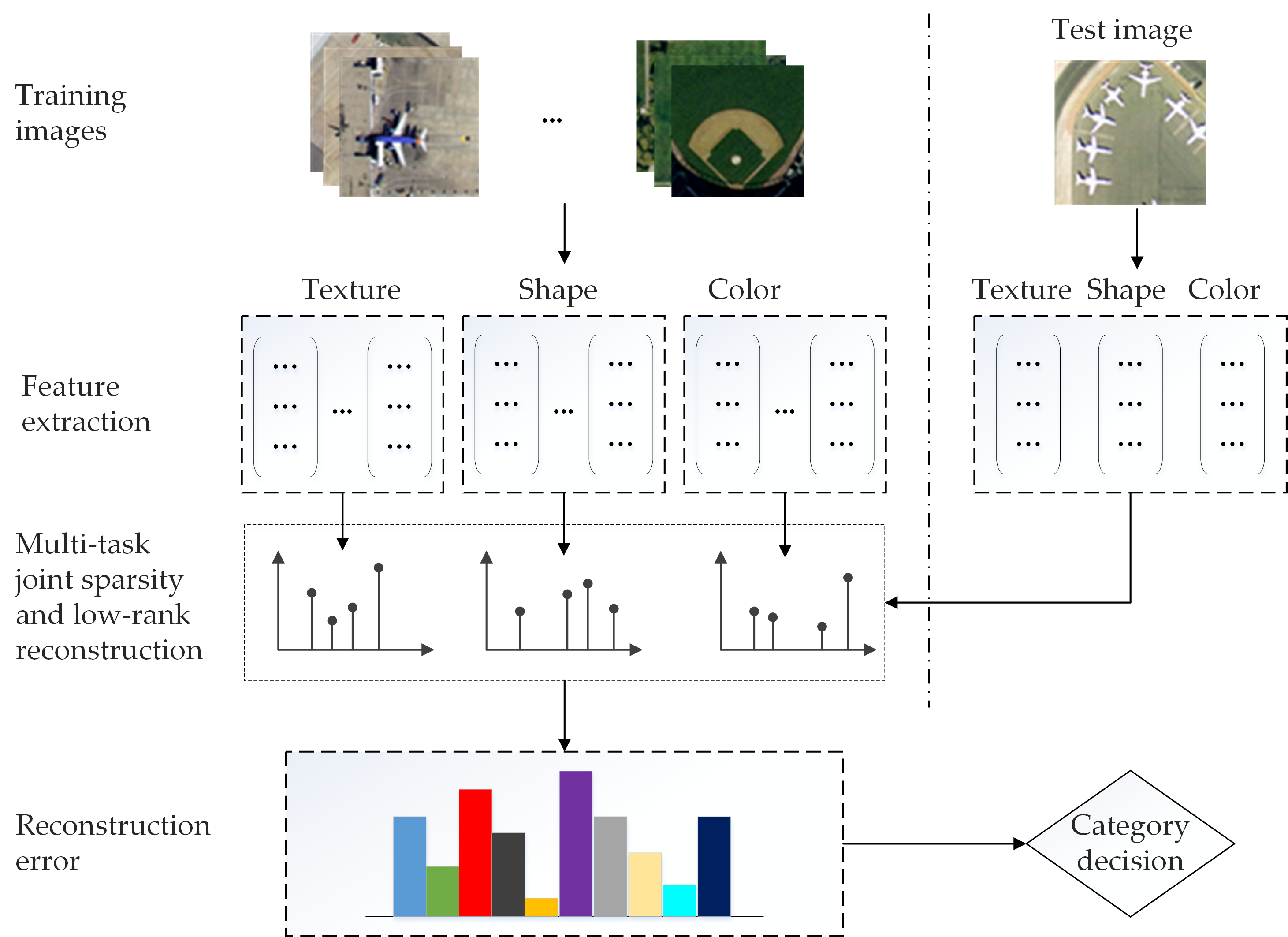
Scene classification plays an important role in the intelligent processing of high-resolution satellite (HRS) remotely sensed image. In HRS image classification, multiple features, e.g. shape, color, and texture features, are employed to represent scenes from different perspectives. Accordingly, effective integration of multiple features always results in better performance compared to methods based on a single feature in the interpretation of HRS image. In this paper, we introduce a multi-task joint sparse and low-rank representation model to combine the strength of multiple features for HRS image interpretation. Specifically, a multi-task learning formulation is applied to simultaneously consider sparse and low-rank structure across multiple tasks. The proposed model is optimized as a non-smooth convex optimization problem using an accelerated proximal gradient method. Experiments on two public scene classification datasets demonstrate that the proposed method achieves remarkable performance and improves upon the state-of-art methods in respective applications.

