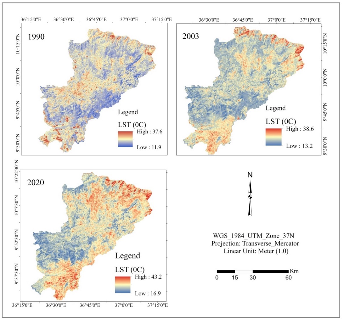
Analysis of the correlation between indices (Normalized Difference Vegetation Index, Normalized Difference Barren Index and Modified Normalized Difference Water Index) and land surface temperature is used to natural resources and environmental studies. This research aimed to analysis of Land Surface Temperature due to dynamics of Different Indices (NDVI, NDBaI and MNDWI) Using Remote Sensing Data in three selected districts (Gida Kiremu, Limu and Amuru), western Ethiopia. From thermal and multispectral bands of landsat imageries (Landsat TM of 1990, landsat ETM+ of 2003 and landsat OLI/TIRS of 2020) Land surface temperature and NDVI, NDBaI and MNDWI were calculated. Correlation analysis was used to indicate relationships between LST with NDVI, NDBaI and MNDWI. The study found that Land Surface Temperature was increased by 50C from 1990 to 2020. Vegetation areas (NDVI) and Water bodies (MNDWI) have strong negative relationship with Land Surface Temperature (R2= 0.99, 0.95) whereas Barren land (NDBaI) has positive relationship with Land Surface Temperature (R2= 0.96). Finally, we recommend the decision makers and environmental analyst to emphasis the importance of vegetation cover and water body to minimize the potential impacts of land surface temperature.

