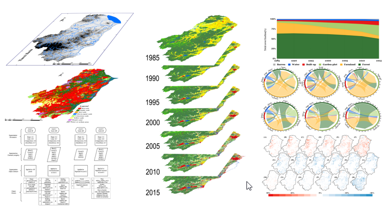
The changing of land use and land cover (LULC) are both affected by climate and human activity and affect climate, biological diversity, and human well-being. Accurate and timely information about the LULC pattern and change is crucial for land management decision-making, ecosystem monitoring, and urban planning, especially in developing economies undergoing industrialization, urbanization, and globalization. Biodiversity degradation and urban expansion in eastern China are research hot-spots. However, the influence of LULC changes on the region remains largely unexplored. Here, an object-based and multi-temporal image analysis approach was developed to detect how LULC changes during 1985-2015 in the Tiaoxi watershed (Zhejiang province, eastern China) using Landsat TM and OLI data. The main objective of this study is to improve the accuracy of unsupervised change detection from object-based and multi-temporal images. To this end, a total of seven LULC maps are generated with multi-temporal images. A random stratified sample design was used for assessing change detection accuracy. The proposed method achieved an overall accuracy of 91.86%, 92.14%, 92.00%, and 93.86% for 2000, 2005, 2010, and 2015, respectively. Nevertheless, the proposed method, in conjunction with object-oriented and multi-temporal satellite images, offers a robust and flexible approach to LULC changes mapping that helps with emergency response and government management. Urbanization and agriculture efficiency are the main reasons for LULC changes in the region. We anticipate that this freely available data will improve the modeling for surface forcing, provide evidence of changes in LULC, and inform water-management decision-making.

