Submitted:
29 May 2023
Posted:
30 May 2023
You are already at the latest version
Abstract
Keywords:
1. Introduction
2. Conceptual Framework
2.1. Coastal management
2.2. Ecological modernization
3. Materials and Methods
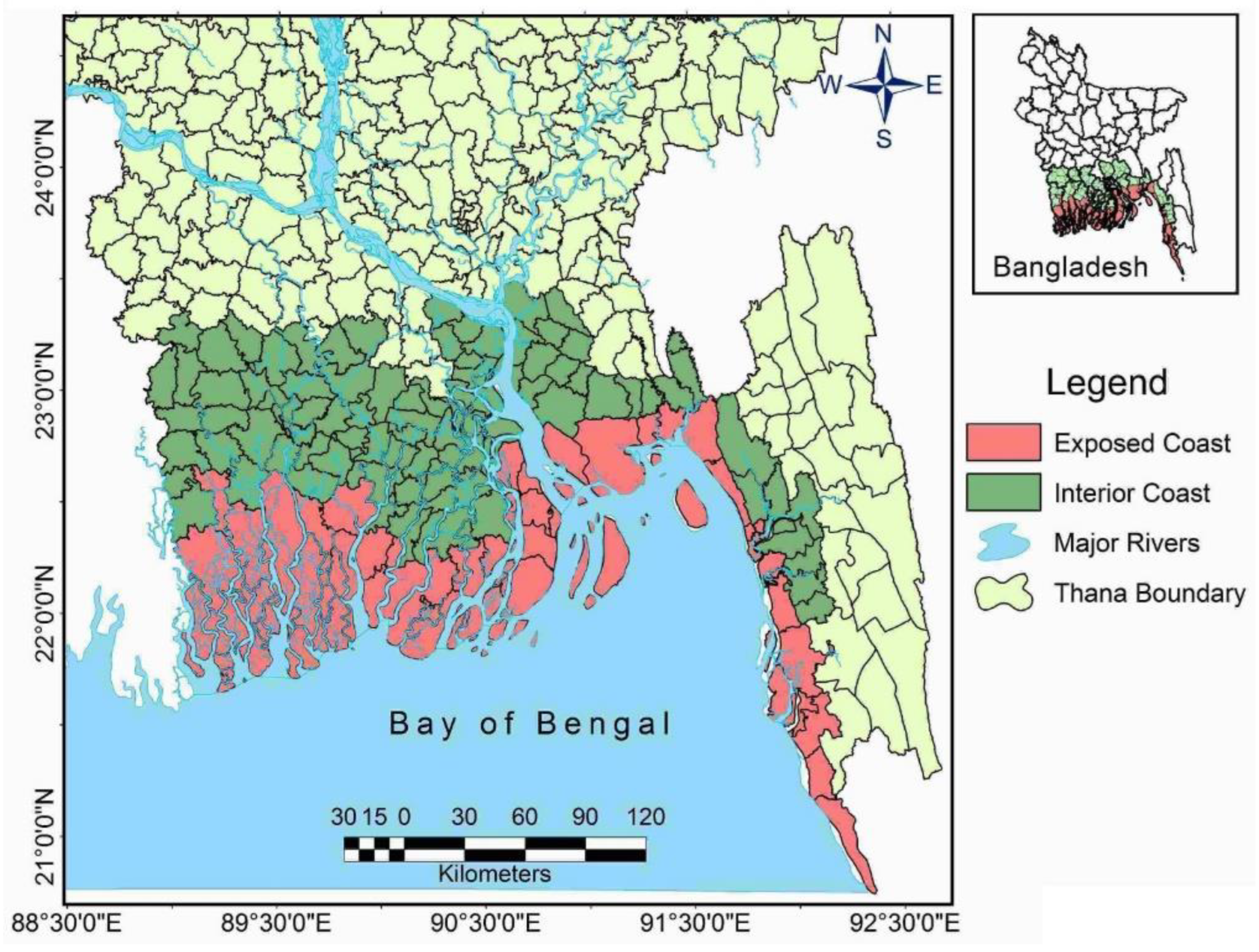
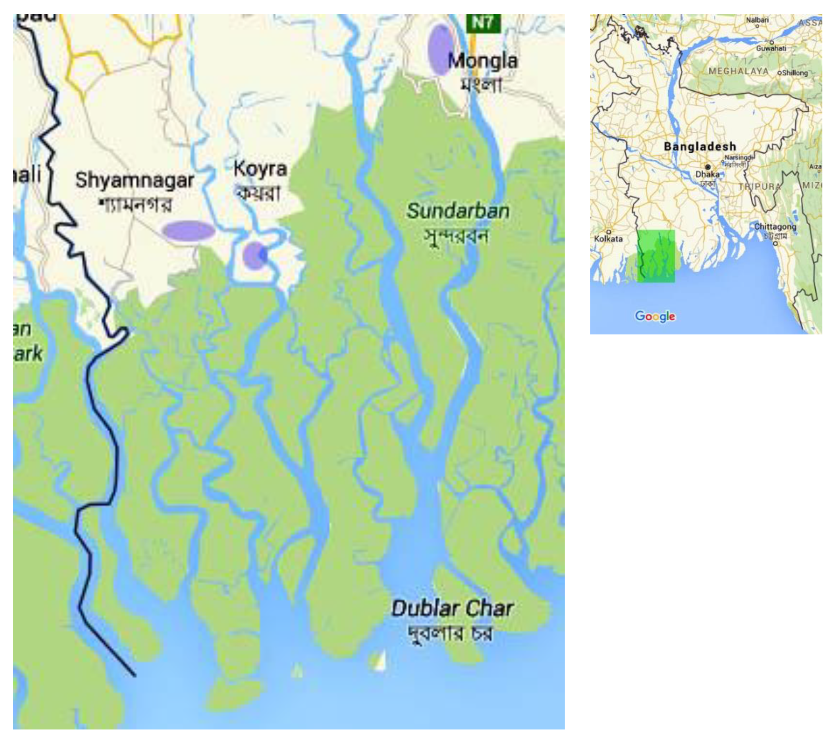
3.1. Study area: coastal Bangladesh
3.2. Content analysis
3.3. Ethnography
3.4. In-depth interview
4. Results and Discussion
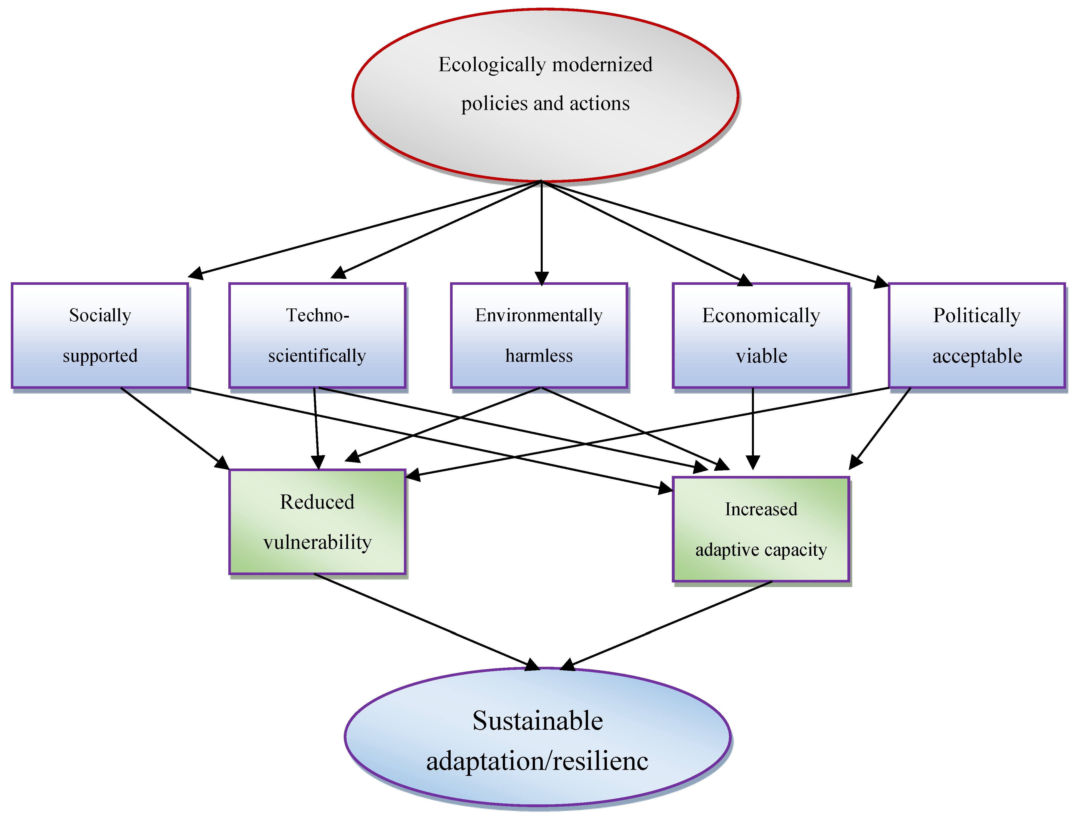
4.1. Ecological modernization approach in addressing adaptation and resilience
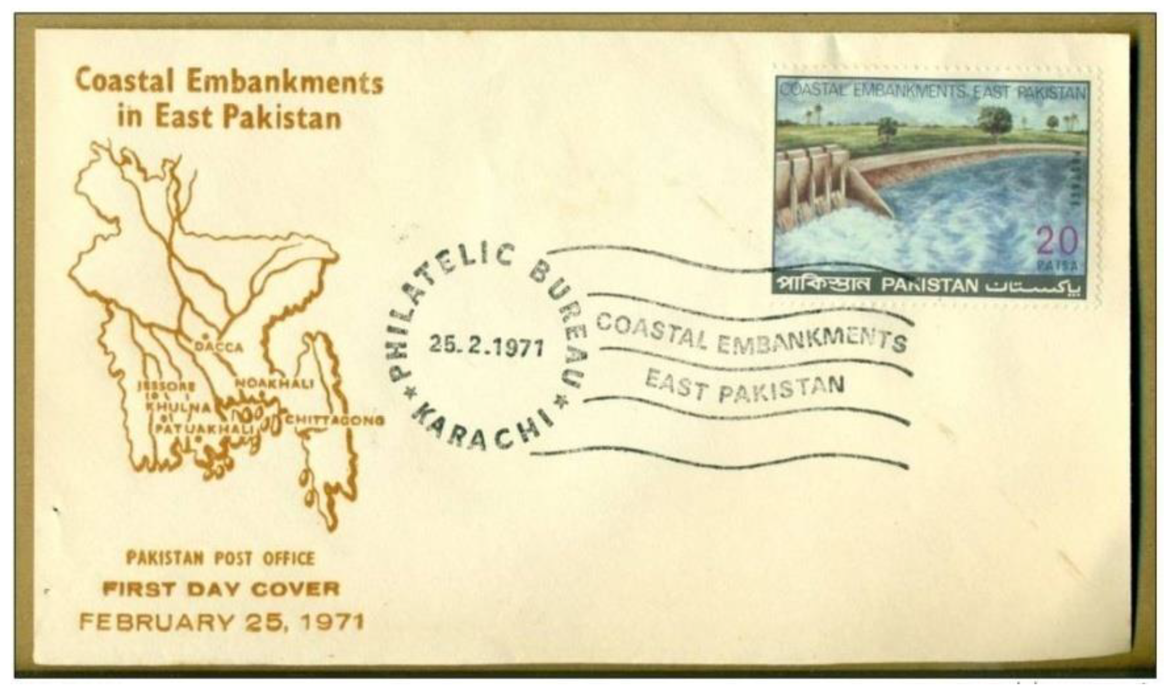
4.2. The Coastal Embankment Project in Bangladesh: A Case Study
4.3. Efficacy of the coastal embankment project
5. Conclusion
| 1 | The districts are Bagerhat, Barguna, Barisal, Bhola, Chandpur, Chittagong, Cox’s Bazar, Feni, Gopalganj, Jessore, Jhalkathi,Khulna, Lakshmipur, Narail, Noakhali, Patuakhali, Pirojpur, Satkhira and Shariatpur (MoWR 2005:2). |
Author Contributions
Funding
Conflicts of Interest
References
- Adua, Lazarus, Richard York and Beth-Anne Schuelke-Leech. 2016. “The human dimensions of climate change: A micro-level assessment of views from the ecological modernization, political economy and human ecology perspectives.” Social Science Research. 56: 26-43. [CrossRef] [PubMed]
- Ahmed, Sultan and Koen de Wilde. 2011. “Setting the Stage”. Pp. 1-19 in Moving Coastlines: Emergence and Use of Land in the Ganges-Brahmaputra-Meghna Estuary, edited by Koen de Wilde. Dhaka: The University Press Limited.
- Akter, Sonia. 2020. “Social cohesion and willingness to pay for cyclone risk reduction: The case for the Coastal Embankment Improvement Project in Bangladesh.” International Journal of Disaster Risk Reduction 48:101579. [CrossRef]
- Alongi, Daniel M. 2008. “Mangrove forests: Resilience, protection from tsunamis, and responses to global climate change.” Estuarine, Coastal and Shelf Science. 76:1-13. [CrossRef]
- Archer, David. 2005. “Fate of Fossil Fuel CO2 in Geologic Time.” Journal of Geophysical Research. 110(C9): C09S05. 1-6. [CrossRef]
- Babbie, Earl. 2021. The Practice of Social Research. Boston: Cengage.
- Baer, Hans A. 2012. Global Capitalism and Climate Change: The Need for an Alternative World System. Lanham: Altamira Press.
- Baily, I., A. Gouldson and P. Newell. 2011. “Ecological Modernization and the Governance of Carbon: A Critical Analysis.” Antipode. 43(3): 682-703. [CrossRef]
- Banglapedia. 2015. “Embankment.” Retrieved March 20, 2016 (http://en.banglapedia.org/index.php?title=Embankment).
- Barnett, J. and S. O’Neil. 2010. “Maldaptation.” Global Environmental Change. 20:211-213.
- BBS (Bangladesh Bureau of Statistics). 2012a. Community Report: Bagerhat Zila. Population and Housing Census 2011. Dhaka: BBS.
- BBS (Bangladesh Bureau of Statistics). 2012b. Community Report: Khulna Zila. Population and Housing Census 2011. Dhaka: BBS.
- BBS (Bangladesh Bureau of Statistics). 2012c. Community Report: Satkhira Zila. Population and Housing Census 2011. Dhaka: BBS.
- Beckman, Malin. 2011. “Converging and conflicting interests in adaptation to environmental change in central Vietnam.” Climate and Development 3(1): 32-41. [CrossRef]
- Below, T., A. Artner, R. Siebert and S. Sieber. 2010. Micro-level Practices to Adapt to Climate Change for African Small-Scale Farmers. IFPRI Discussion Paper 00953, Environment and Production Technology Department, IFPRI.
- Bernard, H. Russel. 2013. Social Research Methods: Qualitative and Quantitative Approaches. Los Angeles: Sage.
- Beveridge, H. 1876. “Were the Sundarbans Inhabited in Ancient Times?” Journal of the Asiatic Society of Bengal 1: 71-76.
- Bowles, E. M. 1965. “East Pakistan’s Master Plan for Water and Power Development.” Civil Engineering 35(8): 56-59.
- Boyce, J. K. 1990. “Birth of a Megaproject: Political Economy of Flood Control in Bangladesh.” Environmental Management 14(4): 419-428. [CrossRef]
- British library (2016). Retrieved March 19, 2016 http://www.bl.uk/onlinegallery/onlineex/apac/other/largeimage68435.html.
- Brown, Katrina. 2011. “Sustainable adaptation: An oxymoron?” Climate and Development 3(1): 21-31. [CrossRef]
- Carter, R. W. G. 1988. Coastal environments. An Introduction to the Physical, Ecological and Cultural Systems of the Coastlines. New York: Academic Press.
- Chakrabarti, Ranjan. 2009. “Local People and the Global Tiger: An Environmental History of the Sundarbans.” Global Environment 3: 72–95. [CrossRef]
- Choudhury, N. Y., A. Paul, and B. K. Paul. 2004. “Impact of Coastal Embankment on the Flash Flood in Bangladesh: A Case Study.” Applied Geography 24: 241–258. [CrossRef]
- Christoff, P. 1996. “Ecological modernisations, ecological modernities.” Environmental Politics. 5(3): 476-501. [CrossRef]
- Crooks, S., D. Herr, J. Tamelander, D. Laffoley, and J. Vandever. 2011. Mitigating Climate Change through Restoration and Management of Coastal Wetlands and Near-shore Marine Ecosystems: Challenges and Opportunities. Environment Department Paper 121. Washington, DC: World Bank.
- Dewan, C., A. Mukherji, and M-C Buisson. 2015. “Evolution of Water Management in Coastal Bangladesh: From Temporary Earthen Embankments to Depoliticized Community-Managed Polders.” Water International. [CrossRef]
- Eakin, H. C, M. C. Lemos, and D. R. Nelson. 2014. “Differentiating capacities as a means to sustainable climate change adaptation.” Global Environmental Change 27: 1–8. [CrossRef]
- Ehler, C., Douvere, F., 2009. Marine Spatial Planning: A Step-by-step Approach toward Ecosystem-based Management, Intergovernmental Oceanographic Commission and Man and the Biosphere Programme. UNESCO, Paris IOC Manual and Guides, No 53, ICAM Dossier, No 6.
- Eriksen, Siri and Katrina Brown. 2011. “Sustainable adaptation to climate change.” Climate and Development. 3(1): 3-6. [CrossRef]
- Eriksen, Siri, Paulina Aldunce, Chandra Sekhar Bahinipati, Rafael D'almeida Martins, John Isaac Molefe, Charles Nhemachena, Karen O'brien, Felix Olorunfemi, Jacob Park, Linda Sygna and Kirsten Ulsrud. 2011. “When not every response to climate change is a good one: Identifying principles for sustainable adaptation.” Climate and Development 3(1): 7-20. [CrossRef]
- Fetterman, David M. 2009. “Ethnography.” Pp. 543-588 in The SAGE Handbook of Applied Social Research, edited by Leonard Bickman and Debra J Rog. Los Angeles: Sage.
- Gachathi, Francis N. and Siri Eriksen. 2011. “Gums and resins: The potential for supporting sustainable adaptation in Kenya's drylands.” Climate and Development 3(1): 59-70. [CrossRef]
- Gain, A. K., M. S. Mondal, and R. Rahman. 2017. “From Flood Control to Water Management: A Journey of Bangladesh towards integrated Water Resources Management.” Water 9(55). [CrossRef]
- Glaas, E., T.-S.Neset, E. Kjellstrom, and A.-J. Almas. 2015. “Increasing house owners’ adaptive capacity: compliance between climate change risks and adaptation guidelines in Scandinavia.” Urban Climate 14: 41-51. [CrossRef]
- Ghosh, Aditya, Susanne Schmidt, Thomas Fickert and Marcus Nüsser. 2015. “The Indian Sundarban Mangrove Forests: History, Utilization, Conservation Strategies and Local Perception.” Diversity 7: 149-169. [CrossRef]
- Glover, Leigh. 2011. “Adaptation to Climate Change as Ecological Modernisation: Australian Experience.” Paper presented in the 2011 European Conference Political Research Conference in Reykjavik, Iceland. 25—27 August. Retrieved March 15, 2016 (https://www.researchgate.net/publication/235768021_Adaptation_to_Climate_Change_as_Ecological_Modernisation_Australian_Experience).
- Goudie, A. S. 2013. The Human Impact on the Natural Environment: Past, Present, and Future. Chichester: John Wiley and Sons, Ltd.
- Gouldson, Andy and Rory Sullivan. 2012. “Ecological modernisation and the spaces for feasible action on climate change.” Pp. 114-125 in Climate Change and the Crisis of Capitalism: A chance to reclaim self, society and nature, edited by Mark Pelling, David Manuel-Navarrete and Michael Redclift. London: Routledge.
- Hajer, Maarten A. 1995. The Politics of Environmental Discourse: Ecological Modernization and the Policy Process. Oxford: Clarendon Press.
- Hajer, Maarten A. 2010. “Ecological Modernization as Cultural Politics.” Pp. 80-100 in The Ecological Modernisation Reader: Environmental Reform in Theory and Practice, edited by Arthur P J Mol, David A Sonnenfeld and Gert Spaargaren. London: Routledge.
- Hammersley, Martyn and Paul Atkinson. 2007. Ethnography. Hoboken: Taylor & Francis.
- Haq, Shafiqul and Joseph I. Burns. 1967. “Coastal Embankment Project for East Pakistan.” Journal of the Waterways and Harbors Division: Proceedings of the American Society of Civil Engineers 5547(WW4): 1-9.
- Harrison, Henry Leland. 1875. The Bengal Embankment Manual. Calcutta: Bengal Secretariat Press.
- Hinrichsen, D. 1998. Coastal Waters of the World: Trends, Threats and Strategies. Washington DC: Island Press.
- Hossain, Z., Z. Islam, and T. Sakai. 2008. “An Investigation on Failure of Embankments in Bangladesh.” International Conference on Case Histories in Geotechnical Engineering. Missouri University of Science and Technology. 14 August 2008.
- Huber, Joseph. 1991[2010]. Ecological Modernization: Beyond Scarcity and Bureaucracy.” Pp. 17-27 in The Ecological Modernisation Reader: Environmental Reform in Theory and Practice, edited by Arthur P. J. Mol, David A. Sonnenfeld and Gert Spaargaren. London: Routledge.
- Hunter, W.W. 1876. Statistical Account of Bengal, Volume1, District of 24 Parganas and Sundarbans. London: Trübner and Company.
- Islam, M. R. 2006. “Managing Diverse Land Uses in Coastal Bangladesh: Institutional Approaches.” Pp. 237-248 in Environment and Livelihoods in Tropical Coastal Zones: Managing Agriculture-Fishery-Aquaculture Conflicts, edited by C. T. Hoanh, T. P. Tuong, J. W. Gowing, and B. Hardy. Oxon: CABI.
- Islam, Md Saidul. 2013. Development, Power, and the Environment: Neoliberal Paradox in the Age of Vulnerability. New York: Routledge.
- Islam, Md Saidul. 2014. Confronting the Blue Revolution: Industrial Aquaculture and Sustainability in the Global South. Toronto: University of Toronto Press.
- Islam, Md Saidul. 2022. “Certification regimes in the global agro-food system and the transformation of nature-society relationship: Ecological modernization or modernization of ecology?” Nature and Culture 17(1): 87-110. [CrossRef]
- Janicke, Martin. 1993[2010]. “On Ecological and Political Modernization.” Pp. 28-41 in The Ecological Modernisation Reader: Environmental Reform in Theory and Practice edited by Arthur P. J. Mol, David A. Sonnenfeld and Gert Spaargaren. London: Routledge.
- Juhola, Sirkku, Erik Glaas, Bjorn-Ola Linner and Tina-Simone Neset. 2016. “Redefining maladaptation.” Environmental Science & Policy. 55: 135–140.
- Kais, S. M. and Md Saidul Islam. 2018. “Impacts of and Resilience to Climate Change at the Bottom of the Shrimp Commodity Chain in Bangladesh: A Preliminary Investigation.” Aquaculture 493 (2018) 406–415. [CrossRef]
- Kais, S. M. and Md Saidul Islam. 2019. “Perception of Climate Change in Shrimp-Farming Communities in Bangladesh: A Critical Assessment.” International Journal of Environmental Research and Public Health 16(672): 1-12. [CrossRef]
- Kais, S. M. and Md Saidul Islam. 2021. “Resilience to Climate Change in Industrial Shrimping in Bangladesh: Assessing the Comparative Role of the Stakeholders” Sustainability 13(307):1-21. [CrossRef]
- Karim, Mohammed Fazlul and Nobuo Mimura. 2008. “Impacts of climate change and sea-level rise on cyclonic storm surge floods in Bangladesh.” Global Environmental Change 18:490-500. [CrossRef]
- Khan, Akbar Ali. 2009. Discovery of Bangladesh: Explorations into Dynamics of a Hidden Nation. Dhaka: The University Press Limited.
- Kiousopoulos, J., 2008. “Methodological Approach of Coastal Areas Concerning Typology and Spatial Indicators, in the Context of Integrated Management and Environmental Assessment.” J. Coast. Conserv. 12(1): 19–25. [CrossRef]
- Klein, R. J. T., S. E. H. Eriksen, L.O. Næss, A. Hammill, T. M. Tanner, C. Robledo and K. L. O’Brien. 2007. “Portfolio screening to support the mainstreaming of adaptation to climate change into development assistance.” Climate Change 84: 23–44. [CrossRef]
- Martin, Carolina, Anna O’Donnell, George Joseph and Quentin Wodon. 2015. “Three approaches to climate change adaptation.” Pp. 9-34 in Climate Change Adaptation and Social Resilience in the Sundarbans, edited by Anna O’Donnell and Quentin Wodon. London: Routledge .
- Martin, Carolina, Carrie Moy, Anna O’Donnell and Quentin Wodon. 2015. “Ecological, historical and socio-economic context.” Pp. 65-86 Climate Change Adaptation and Social Resilience in the Sundarbans, edited by Anna O’Donnell and Quentin Wodon. London: Routledge.
- Martínez, M. L., A. Intralawan, G. Vázquez, O. Pérez-Maqueo, P. Sutton, and R. Landgrave. 2007. “The coasts of our world: Ecological, economic and social importance.” Ecological Economics 63:254-272. [CrossRef]
- Matthews, H. D. and K. Caldeira. 2008. “Stabilizing climate requires near-zero emissions.” Geophysical Research Letters 35: L04705. [CrossRef]
- McGray, H., A. Hammill and R. Bradley. 2007. Weathering the Storm: Options for Framing Climate Change and Development.WRI Report. Washington DC: World Resources Institute.
- Mearns, R. and A. Norton (eds). 2010. Social Dimensions of Climate Change: Equity and Vulnerability in a Warming World. Washington DC: The World Bank.
- Merriam-Webster. 2023. “Coast.” Merriam-Webster.com Dictionary. Retrieved 16 May 2023 https://www.merriam-webster.com/dictionary/coast.
- Miller, M. L. and N. P. Hadley. 2019. “Tourism and Coastal Development.” Pp. 1773-1785 in Encyclopedia of Coastal Science, edited by C. W. Finkle and C. Makowski. Cham, Switzerland: Springer Nature.
- MoA and FAO. 2013. Master Plan for Agricultural Development in the Southern Region of Bangladesh. Dhaka: Ministry of Agriculture (MoA), Government of the People's Republic of Bangladesh and Food and Agriculture Organization (FAO) of the United Nations.
- Mol, Arthur P. J. 1995. The Refinement of Production: Ecological Modernization Theory and the Chemical Industry. The Haag: CIP-DATA KONINKLIJKE BIBLIOTHEEK.
- Mol, Arthur P. J. and Martin Janicke. 2010. “The Origins and Theoretical Foundations of Ecological Modernization Theory.” Pp. 17-27 in The Ecological Modernisation Reader: Environmental Reform in Theory and Practice, edited by Arthur P J Mol, David A Sonnenfeld and Gert Spaargaren. London: Routledge.
- Mondal, M. K., S. C. Rajan. 2009. “Climate Migrants in Bangladesh: Estimates and Solution”. Pp. 225-235 in Climate Change Impacts and Adaptation Strategies for Bangladesh, edited by M. Habibur Rahman, A. B. M. Badruzzaman, Md. Jobair Bin Alam, Md. Mafizur Rahman, M. Ashraf Ali, Munaz Ahmed Noor and Zia Wadud. Dhaka: ITN-BUET.
- MoWR (Ministry of Water Resources). 2005. Coastal Zone Policy 2005. Dhaka: MoWR, Government of the People's Republic of Bangladesh.
- Mukerjee, R. 1938. The Changing Face of Bengal: A Study in Riverine Economy. Calcutta: University of Calcutta.
- Mumford, L. 1961. The City in History. London: Penguin.
- Murphy, Joseph and Andrew Gouldson. 2000. “Environmental policy and industrial innovation: integrating environment and economy through ecological modernisation.” Geoforum 31: 33-44. [CrossRef]
- Novak, James J. 2008. Bangladesh: Reflections on the Water. Dhaka: The University Press Limited.
- O’Malley, Lewis Sydney Steward. 1908. Eastern Bengal District Gazetteers, Khulna. Calcutta: The Bengal Secretariat Book Depot.
- Owuor , Bernard, Wycliffe Mauta and Siri Eriksen. 2011. “Sustainable adaptation and human security: Interactions between pastoral and agropastoral groups in dryland Kenya.” Climate and Development 3(1): 42-58. [CrossRef]
- Quezada, George, George Grozev, Seongwon Seo, and Chi-Hsiang Wang. 2014. “The challenge of adapting centralised electricity systems: peak demand and maladaptation in South East Queensland, Australia.” Regional Environmental Change. 14:463–473. [CrossRef]
- Payne, Geoff and Judy Payne. 2004. Key Concepts in Social Research. London: Sage Publications.
- Peerbolte, Bart and Md. Hasan Zubair. 2011. “Unprotected Areas, Polder Development and Operation & Maintenance (O & M).” Pp. 39-62 in Moving Coastlines: Emergence and Use of Land in the Ganges-Brahmaputra-Meghna Estuary, edited by Koen de Wilde. Dhaka: The University Press Limited.
- Rahman, Laskar Muqsudur. 2000. The Sundarbans: A Unique Wilderness of the World. USDA Forest Service Proceedings. RMRS-P-15-VOL-2:143-148.
- Rahman, Tahmina and Khondaker Hasibul Kabir. 2013. “Effects of Embankments on the Habitation of the South-western Coastal Region of Bangladesh.” Asian Journal of Environment and Disaster Management 5(1): 65-80. [CrossRef]
- Rashid, Harun and Bimal Paul. 2014. Climate Change in Bangladesh: Confronting Impending Disasters. Lanham: Lexington Books.
- Rashid, Tawhida. 2014. Holocene Sea-level Scenarios in Bangladesh. Singapore: Springer.
- Rempis, N., G. Alexandrakis, G. Tsilimigkas, and N. Kampanis. 2018. “Coastal Use Synergies and Conflicts Evaluation in the Framework of Spatial, Development and Sectoral Policies.” Ocean and Coastal Management 166: 40–51. [CrossRef]
- Roy, Pinaki. 2014. “Coastal Bangladesh turns too salty for salt-tolerant rice.” Thethirdpole.net. Retrieved February 12, 2016 (http://www.thethirdpole.net/2014/12/08/coastal-bangladesh-turns-too-salty-for-salt-tolerant-rice/).
- Sarkar, Sutapa Chatterjee. 2012. “Bengal’s southern frontier, 1757 to 1948.” Studies in History 28(1): 69–97. [CrossRef]
- Sarwar, Md. Golam Mahbub. 2013. “Sea-level Rise Along the Coast of Bangladesh.” Pp. 217-231 in Disaster Risk Reduction Approaches in Bangladesh, edited by Rajib Shaw, Fuad Mallick, and Aminul Islam. Tokyo: Springer.
- Schmidt, Oswald. 1969. “East Pakistan Coastal Embankment Project.” The Professional Geographer. XXI(4): 252-254. [CrossRef]
- Schipper, E. L. F. 2020. “Maladaptation: When Adaptation to Climate Change Goes Very Wrong”. One Earth 3: 409-414. [CrossRef]
- Spaargaren, Gert and Arthur P. J. Mol. 2010. “Sociology, Environment, and Modernity: Ecological Modernization as a Theory of Social Change.” Pp. 56-79 in The Ecological Modernisation Reader: Environmental Reform in Theory and Practice, edited by Arthur P. J. Mol, David A. Sonnenfeld and Gert Spaargaren. London: Routledge.
- Spaargaren, Gert and Bas van Vliet. 2000. “Lifestyles, consumption, and the environment: the ecological modernization of domestic consumption”. Environmental Politics 9(1): 50-76. [CrossRef]
- Spaargaren, Gert and Peter Oosterveer. 2010. “Citizen-consumers as agents of change in globalizing modernity: the case of sustainable consumption.” Sustainability 2(7): 1887-1908.
- Thomas, J. W. 1974. “Development Institutions, Projects, and Aid: A Case Study of the Water Development Programme in East Pakistan.” Pakistan Economic and Social Review 12(1): 77-103.
- Tracy, Sarah J. 2013. Qualitative Research Methods: Collecting Evidence, Crafting Analysis, Communicating Impact. Chichester: Wiley-Blackwell.
- UNEP-WCMC. 2006. In the Front Line: Shoreline Protection and Other Ecosystem Services from Mangroves and Coral Reefs. Cambridge: UNEP-WCMC.
- Valeila, I. 2006. Global Coastal Change. Malden: Blackwell Publishing.
- Van Maanen. 1979. “The Fact of Fiction in Organizational Ethnography.” Administrative Science Quarterly 24:539-611. [CrossRef]
- Warren, Carol A B and Tracy Xavia Karner. 2015. Discovering Qualitative Methods: Ethnography, Interviews, Documents, and Images. New York: Oxford University Press.
- Weale, A. 1992. The New Politics of Pollution. Manchester: Manchester University Press.
- Wilkie, M. L. and S. Fortuna. 2003. Status and Trends in Mangrove Area Extent Worldwide. Forest Resources Assessment Working Paper 63. Forest Resources Division. Rome: FAO.
- World Bank. 2000. Bangladesh: Climate Change and Sustainable Development. Report No. 21104-BD. Washington: The World Bank.
- World Bank. 2005. Project Performance Assessment Report: Bangladesh Coastal Embankment Rehabilitation Project. Report No. 31565. Washington, DC: The World Bank.
- World Bank Group. 2010. Economics of Adaptation to Climate Change: Bangladesh. Washington: The World Bank Group.
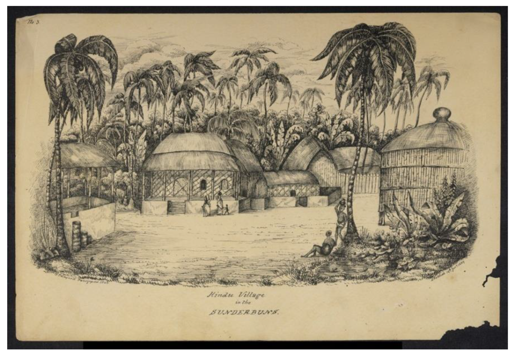
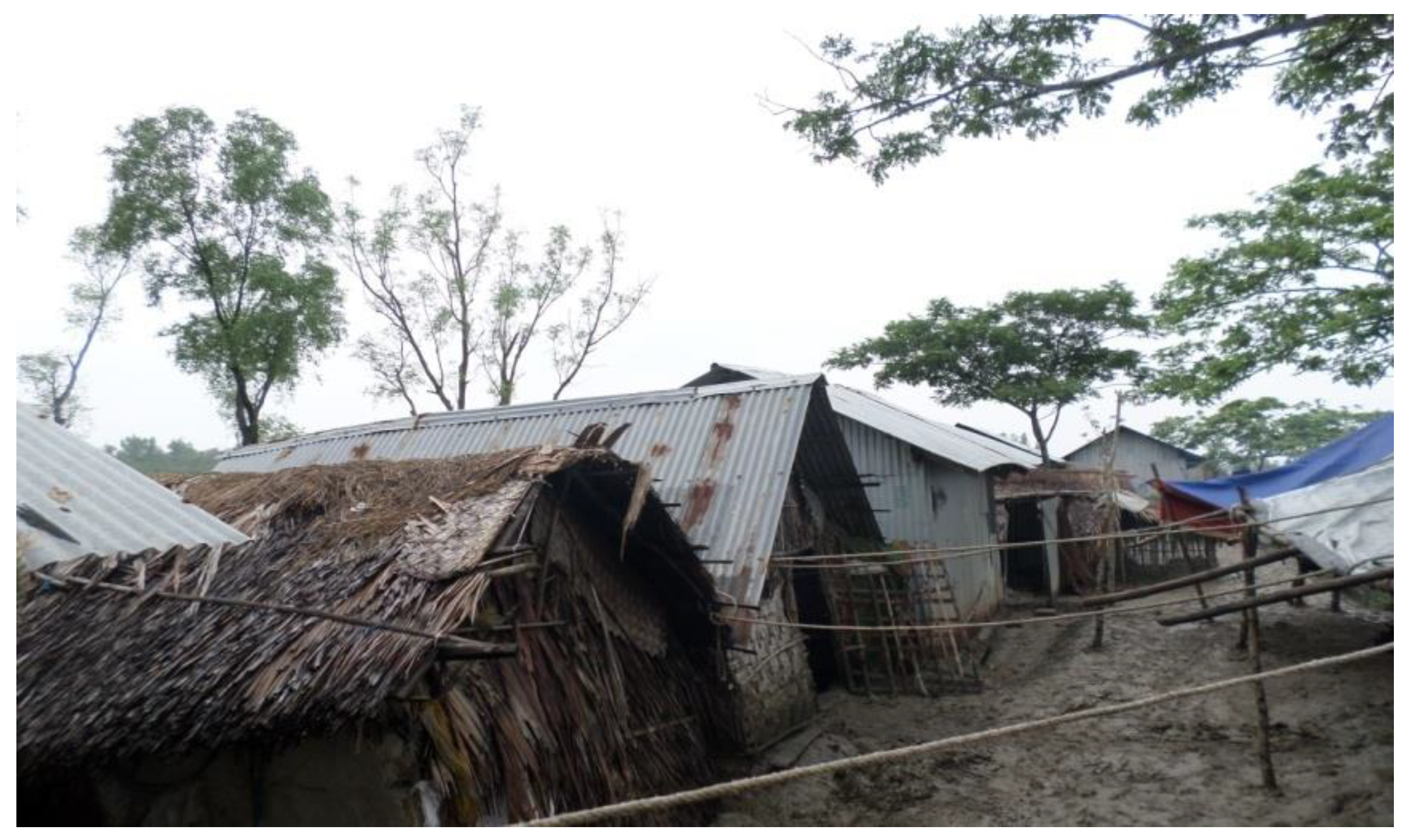
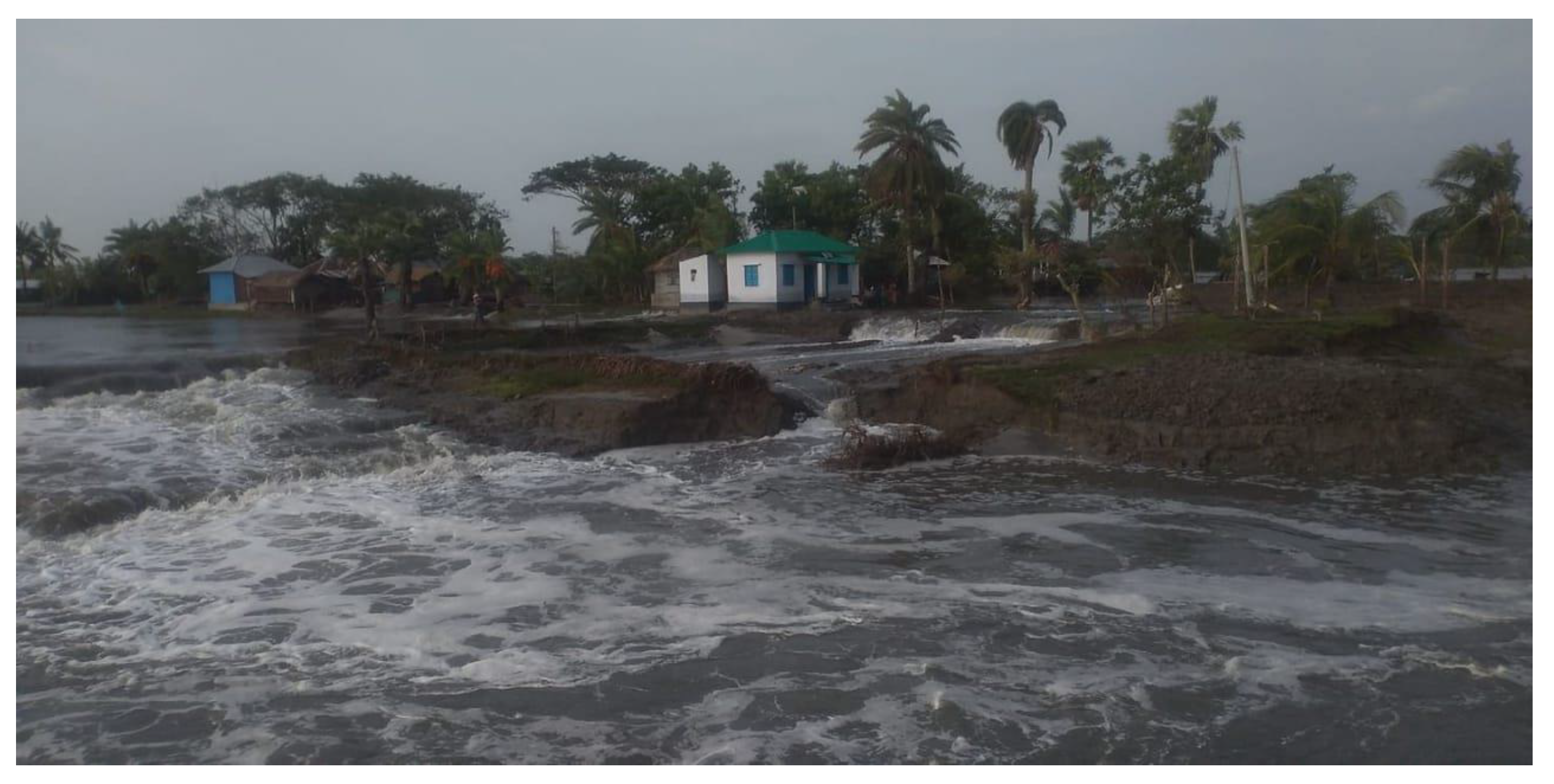
| Participants | Area | Total | ||
|---|---|---|---|---|
| Bagerhat | Khulna | Satkhira | ||
| Upazila Agricultural Officer | 1 | 1 | 1 | 3 |
| Upazila Fisheries Officer | 1 | 1 | 1 | 3 |
| BWDB official | 1 | 1 | 1 | 3 |
| Key informant | 1 | 1 | 1 | 3 |
| Shrimp farmer | 5 | 5 | 5 | 15 |
| Total | 9 | 9 | 9 | 27 |
Disclaimer/Publisher’s Note: The statements, opinions and data contained in all publications are solely those of the individual author(s) and contributor(s) and not of MDPI and/or the editor(s). MDPI and/or the editor(s) disclaim responsibility for any injury to people or property resulting from any ideas, methods, instructions or products referred to in the content. |
© 2023 by the authors. Licensee MDPI, Basel, Switzerland. This article is an open access article distributed under the terms and conditions of the Creative Commons Attribution (CC BY) license (http://creativecommons.org/licenses/by/4.0/).


