Submitted:
11 May 2024
Posted:
13 May 2024
You are already at the latest version
Abstract
Keywords:
1. Introduction
2. Materials and Methods
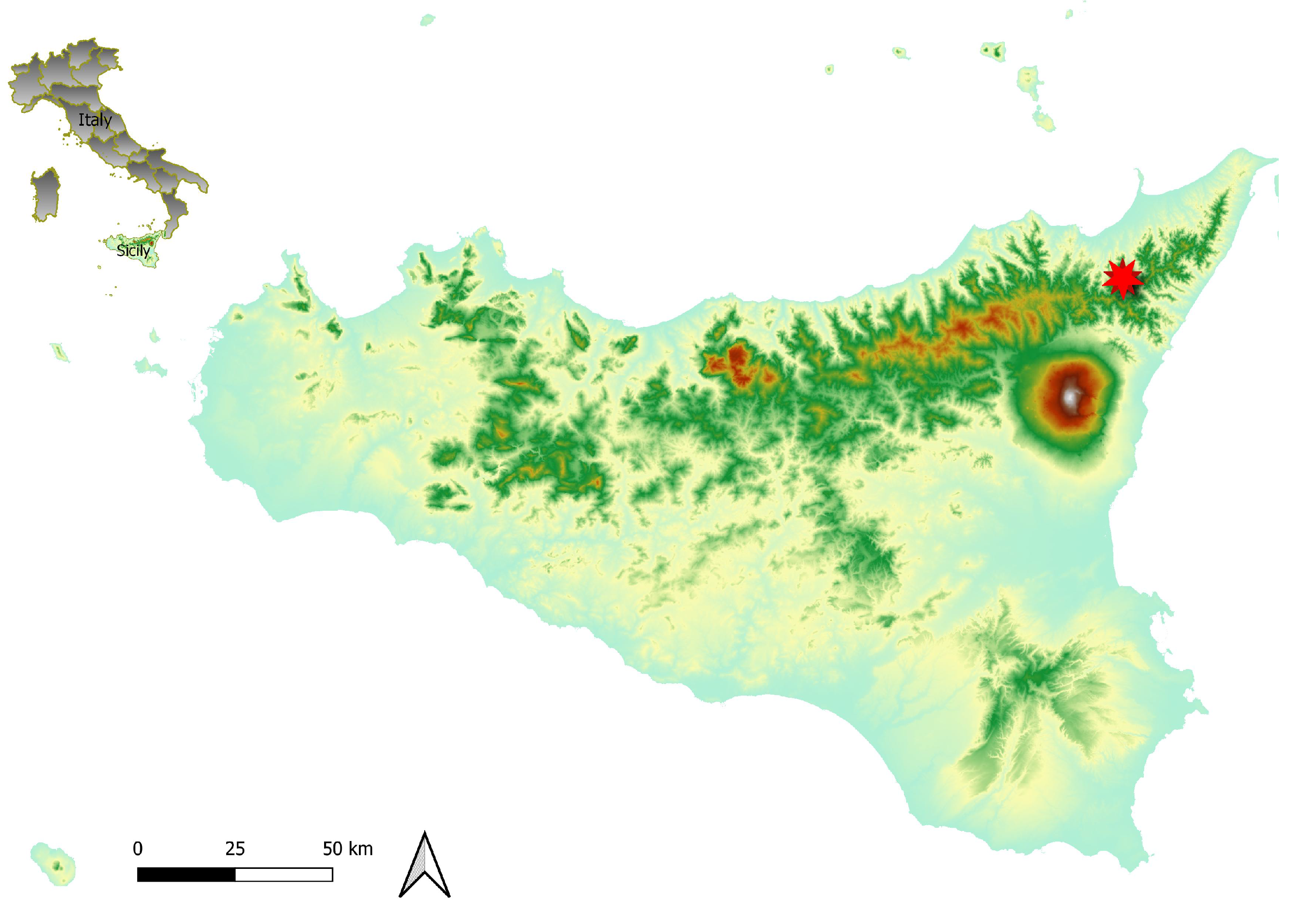
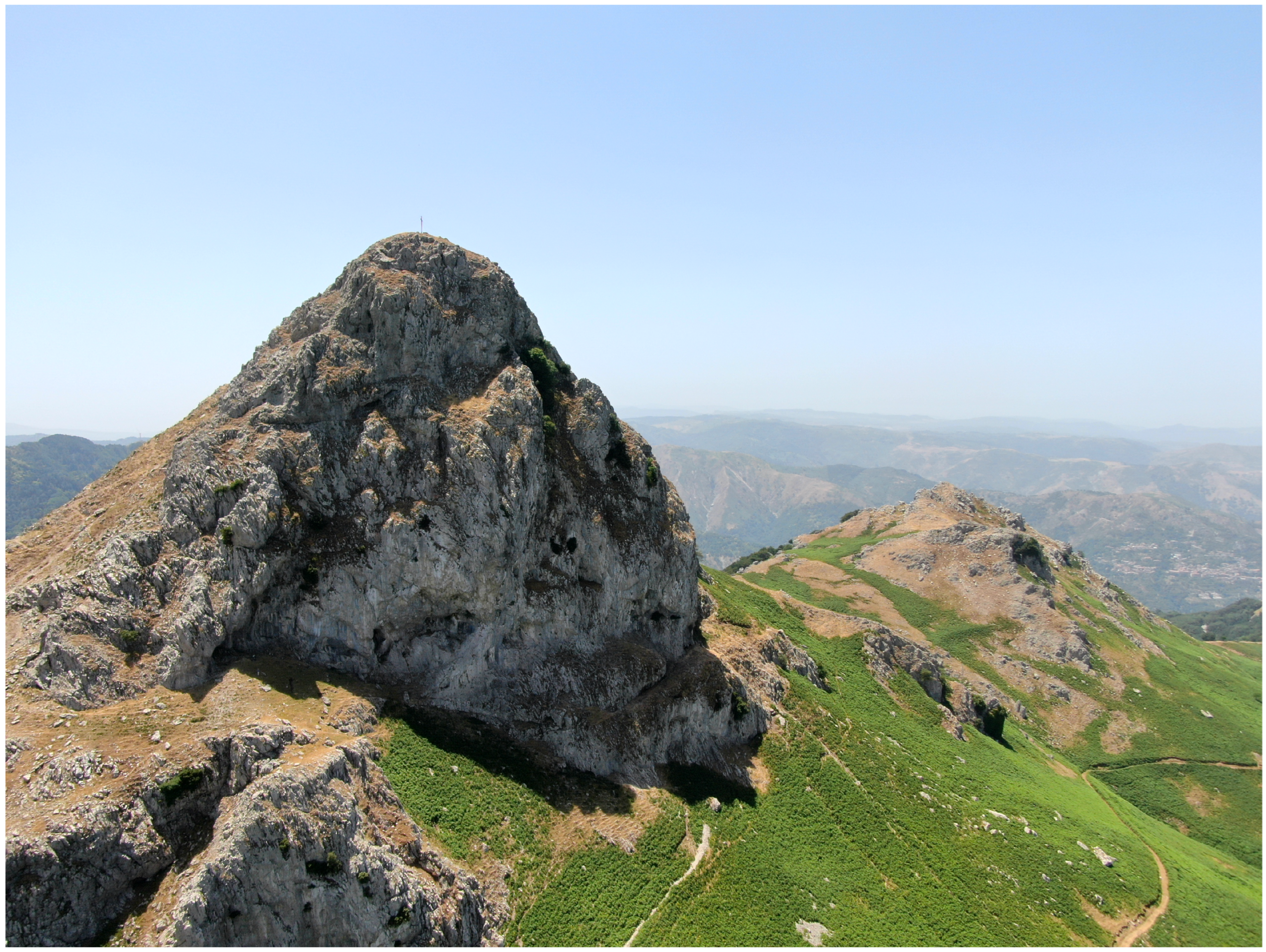
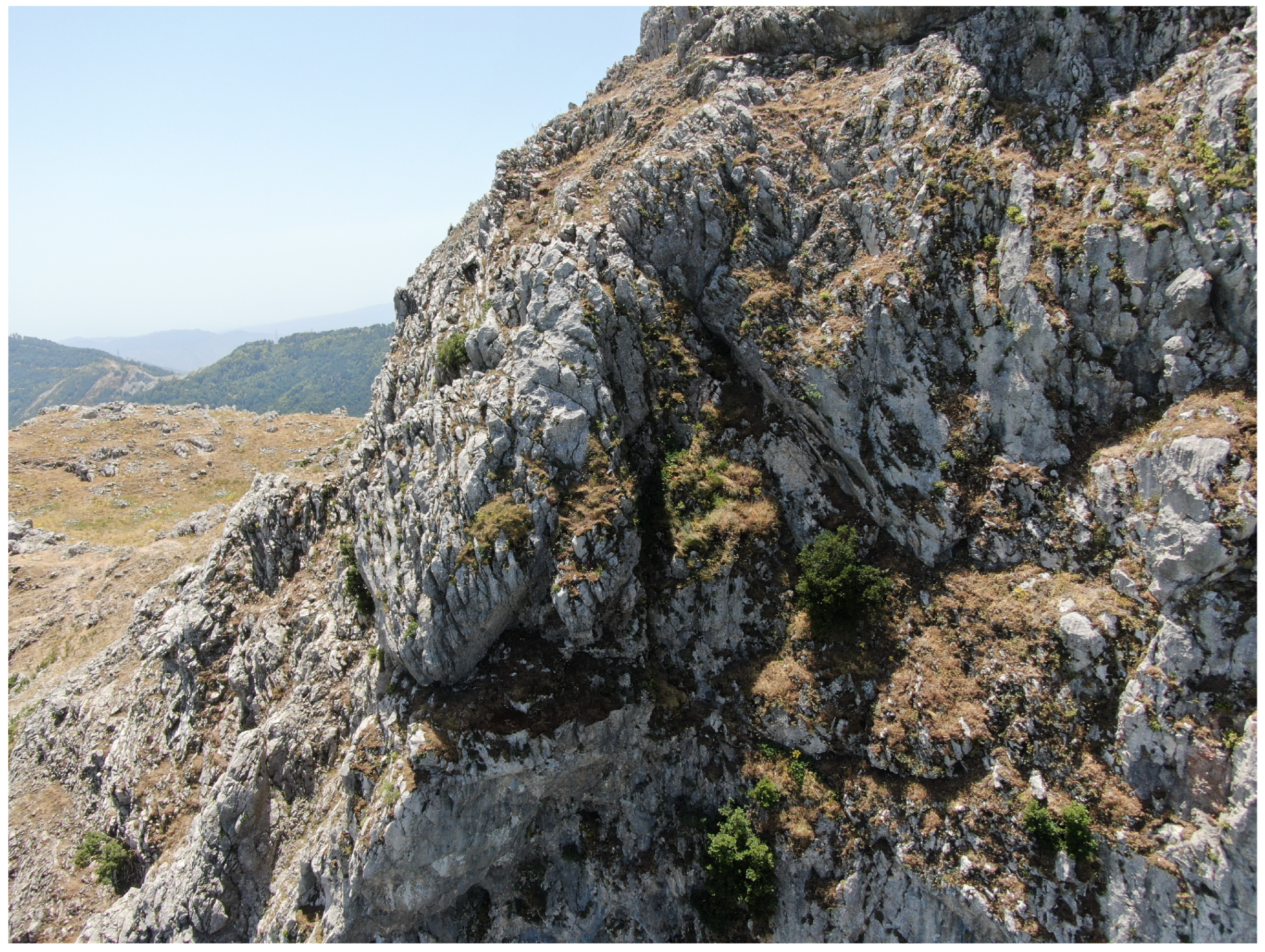
2.1. Study Area
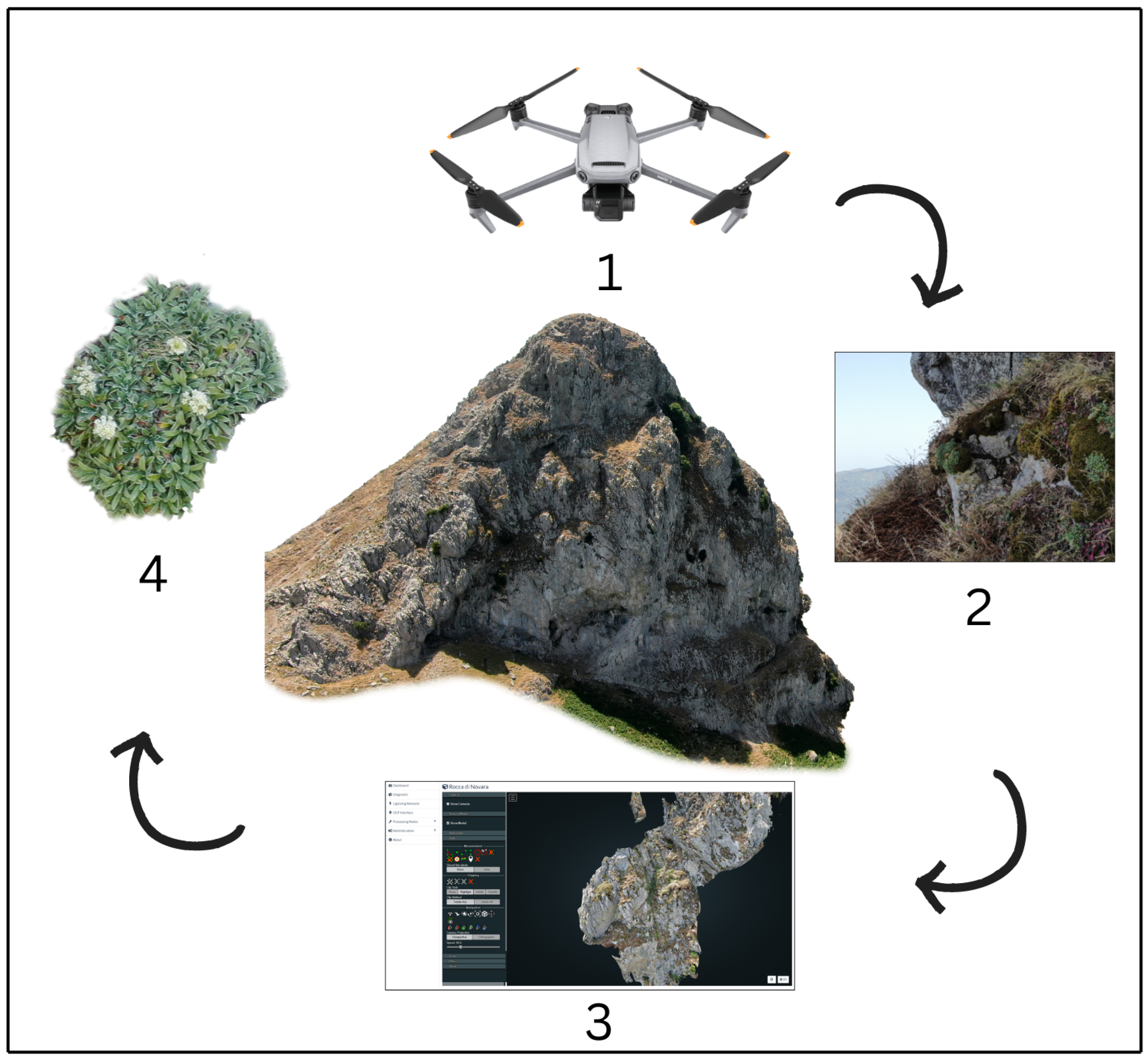
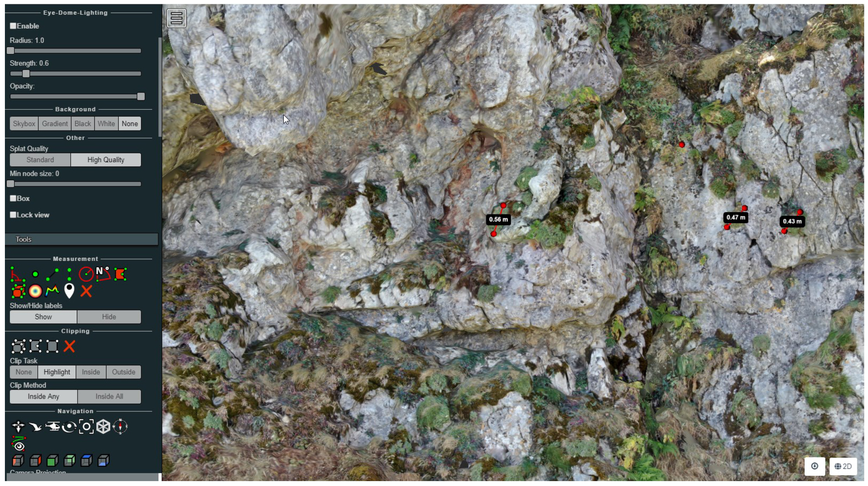
2.2. Drone Surveys and Data Collection
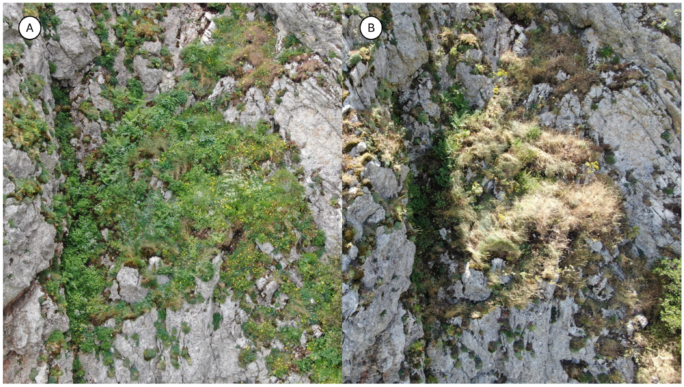
2.3. Vegetation Sampling and Taxa Identification
3. Results and Discussion
3.1. Taxa of Outstanding Interest
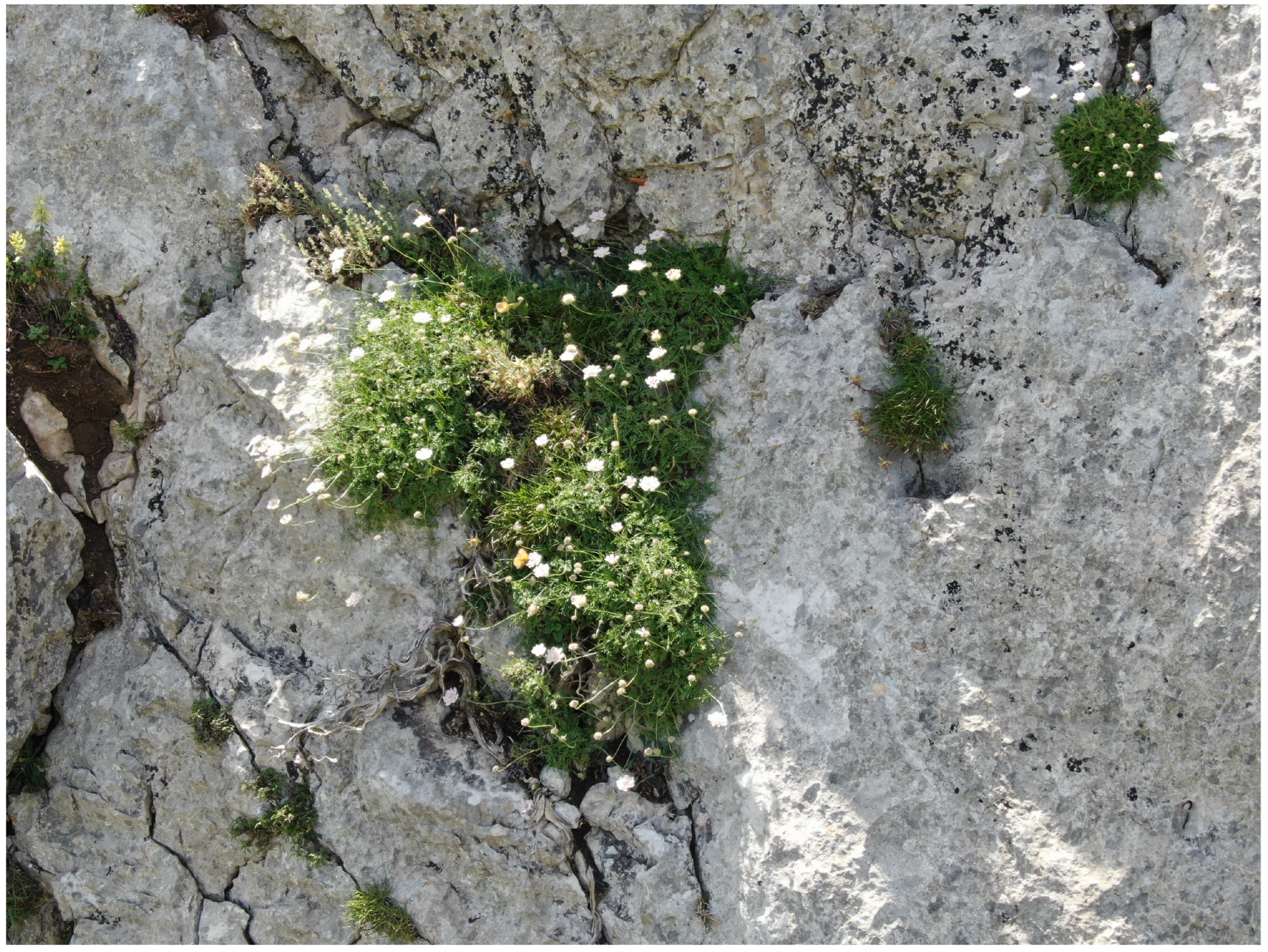
3.1.1. Lomelosia crenata (Cirillo) Greuter & Burdet subsp. crenata
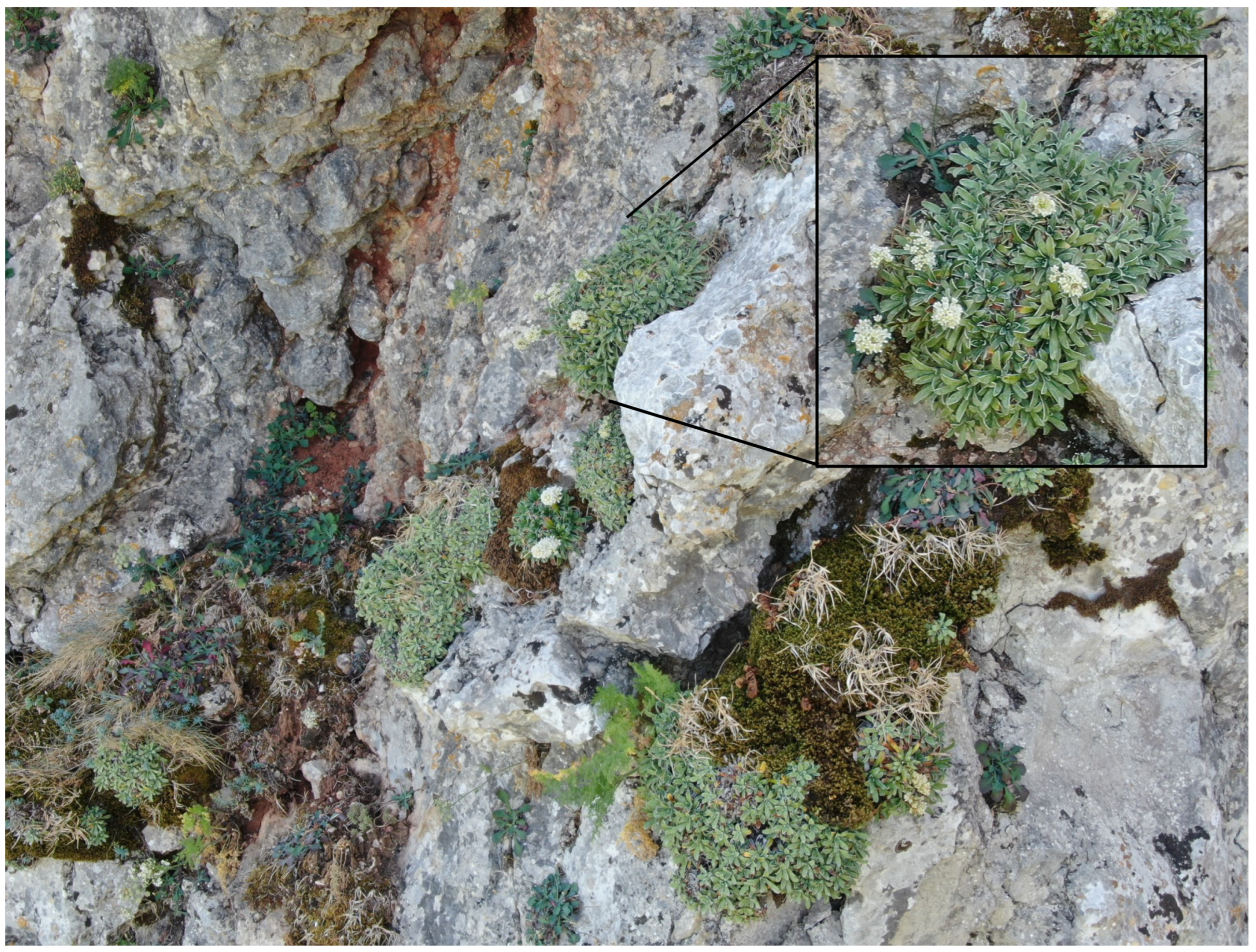
3.1.2. Saxifraga callosa subsp. australis (Moric.) Pignatti ex Tavilla & Del Guacchio
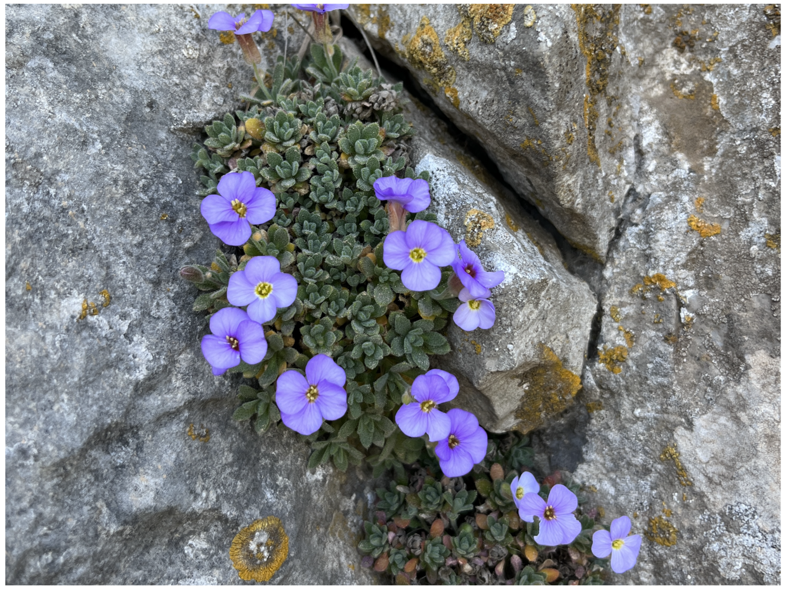
3.1.3. Aubrieta columnae Guss. subsp. sicula (Strobl) M.A.Koch, D.A.German & R.Karl
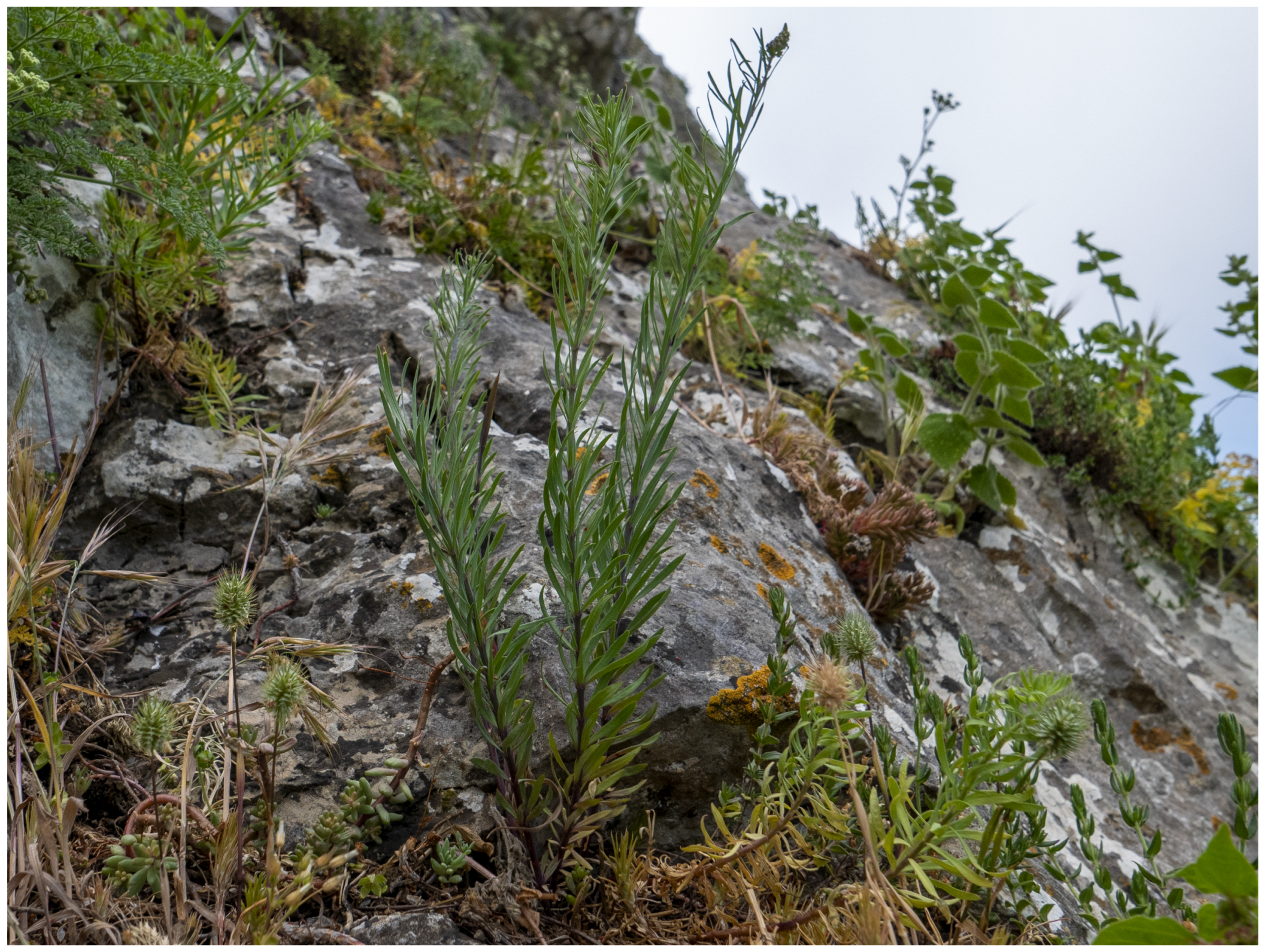
3.1.4. Odontites bocconei (Guss.) Walp. subsp. bocconei
4. Conclusions
Author Contributions
Institutional Review Board Statement
Informed Consent Statement
Data Availability Statement
Acknowledgments
Conflicts of Interest
References
- Directive, H.; others. Council Directive 92/43/EEC of 21 May 1992 on the conservation of natural habitats and of wild fauna and flora. Official Journal of the European Union 1992, 206, 50. [Google Scholar]
- Evans, D. The Habitats of the European Union Habitats Directive. Biology and Environment: Proceedings of the Royal Irish Academy 2006, 106B, 167–173. [Google Scholar] [CrossRef]
- Médail, F.; Baumel, A. Using phylogeography to define conservation priorities: The case of narrow endemic plants in the Mediterranean Basin hotspot. Biological Conservation 2018, 224, 258–266. [Google Scholar] [CrossRef]
- Medail, F.; Quezel, P. Biodiversity hotspots in the Mediterranean Basin: setting global conservation priorities. Conservation biology 1999, 13, 1510–1513. [Google Scholar] [CrossRef]
- Bunce, R.; Metzger, M.; Jongman, R.; Brandt, J.; De Blust, G.; Elena-Rossello, R.; Groom, G.B.; Halada, L.; Hofer, G.; Howard, D.; others. A standardized procedure for surveillance and monitoring European habitats and provision of spatial data. Landscape ecology 2008, 23, 11–25. [Google Scholar] [CrossRef]
- Tavilla, G.; Angiolini, C.; Bagella, S.; Bonini, F.; Cambria, S.; Caria, M.C.; Esposito, A.; Fanfarillo, E.; Ferri, V.; Fiaschi, T.; Gianguzzi, L.; del Galdo, G.G.; Ilardi, V.; Mei, G.; Minissale, P.; Rivieccio, G.; Sciandrello, S.; Stinca, A.; Bazan, G. New national and regional Annex I Habitat records: from #37 to #44. Plant Sociology 2022, 59, 49–66. [Google Scholar] [CrossRef]
- Pimm, S.L.; Alibhai, S.; Bergl, R.; Dehgan, A.; Giri, C.; Jewell, Z.; Joppa, L.; Kays, R.; Loarie, S. Emerging technologies to conserve biodiversity. Trends in ecology & evolution 2015, 30, 685–696. [Google Scholar]
- Jiménez López, J.; Mulero-Pázmány, M. Drones for Conservation in Protected Areas: Present and Future. Drones 2019, 3. [Google Scholar] [CrossRef]
- Koh, L.P.; Wich, S.A. Dawn of drone ecology: low-cost autonomous aerial vehicles for conservation. Tropical conservation science 2012, 5, 121–132. [Google Scholar] [CrossRef]
- Wich, S.A.; Koh, L.P. Conservation Drones: Mapping and Monitoring Biodiversity; Oxford University Press, 2018. [CrossRef]
- Strumia, S.; Buonanno, M.; Aronne, G.; Santo, A.; Santangelo, A. Monitoring of Plant Species and Communities on Coastal Cliffs: Is the Use of Unmanned Aerial Vehicles Suitable? Diversity 2020, 12. [Google Scholar] [CrossRef]
- Bryson, M.; Reid, A.; Hung, C.; Ramos, F.T.; Sukkarieh, S. , O.; Kumar, V.; Sukhatme, G., Eds.; Springer Berlin Heidelberg: Berlin, Heidelberg, 2014; pp. 509–523. doi:10.1007/978-3-642-28572-1_35.Applications. In Experimental Robotics: The 12th International Symposium on Experimental Robotics; Khatib, O., Kumar, V., Sukhatme, G., Eds.; Springer Berlin Heidelberg: Berlin, Heidelberg, 2014; Springer Berlin Heidelberg: Berlin, Heidelberg, 2014; pp. 509–523. [Google Scholar] [CrossRef]
- Green, D.R.; Hagon, J.J.; Gómez, C.; Gregory, B.J. Chapter 21 - Using Low-Cost UAVs for Environmental Monitoring, Mapping, and Modelling: Examples From the Coastal Zone. In Coastal Management; Krishnamurthy, R.; Jonathan, M.; Srinivasalu, S.; Glaeser, B., Eds.; Academic Press, 2019; pp. 465–501. [CrossRef]
- Dunford, R.; Michel, K.; Gagnage, M.; Piégay, H.; Trémelo, M.L. Potential and constraints of Unmanned Aerial Vehicle technology for the characterization of Mediterranean riparian forest. International Journal of Remote Sensing 2009, 30, 4915–4935. [Google Scholar] [CrossRef]
- Eischeid, I.; Soininen, E.M.; Assmann, J.J.; Ims, R.A.; Madsen, J.; Pedersen; Pirotti, F. ; Yoccoz, N.G.; Ravolainen, V.T. Disturbance Mapping in Arctic Tundra Improved by a Planning Workflow for Drone Studies: Advancing Tools for Future Ecosystem Monitoring. Remote Sensing 2021, 13. [Google Scholar] [CrossRef]
- Bersaglio, B.; Enns, C.; Goldman, M.; Lunstrum, L.; Millner, N. Grounding drones in political ecology: understanding the complexities and power relations of drone use in conservation. Global Social Challenges Journal 2023, 2, 47–67. [Google Scholar] [CrossRef]
- Li, M.; Yan, E.; Zhou, H.; Zhu, J.; Jiang, J.; Mo, D. A novel method for cliff vegetation estimation based on the unmanned aerial vehicle 3D modeling. Frontiers in Plant Science 2022, 13. [Google Scholar] [CrossRef] [PubMed]
- Pucino, N.; Kennedy, D.M.; Carvalho, R.C.; Allan, B.; Ierodiaconou, D. Citizen science for monitoring seasonal-scale beach erosion and behaviour with aerial drones. Scientific reports 2021, 11, 3935. [Google Scholar] [CrossRef] [PubMed]
- Theuerkauf, E.J.; Bunting, E.L.; Mack, E.A.; Rabins, L.A. Initial insights into the development and implementation of a citizen-science drone-based coastal change monitoring program in the Great Lakes region. Journal of Great Lakes Research 2022, 48, 606–613. [Google Scholar] [CrossRef]
- Treccani.it. https://www.treccani.it/enciclopedia/sicilia_res-51b7c2ab-973b-11e5-8844-00271042e8d9/, accessed on 14.04.2024.
- Portal to the Flora of Italy. http:/dryades.units.it/floritaly, accessed on 14.04.2024.
- Minissale, P.; Cambria, S.; Montoleone, E.; Tavilla, G.; Giusso del Galdo, G.; Sciandrello, S.; Badalamenti, E.; Mantia, T.L. The alien vascular flora of the Pantelleria Island National Park (Sicily Channel, Italy): new insights into the distribution of some potentially invasive species. BioInvasions Records 2023, 12, 861–885. [Google Scholar] [CrossRef]
- Sciandrello, S.; Cambria, S.; Giusso del Galdo, G.; Guarino, R.; Minissale, P.; Pasta, S.; Tavilla, G.; Cristaudo, A. Floristic and Vegetation Changes on a Small Mediterranean Island over the Last Century. Plants 2021, 10. [Google Scholar] [CrossRef] [PubMed]
- Brullo, S.; Minissale, P.; Spampinato, G. Considerazioni fitogeografiche sulla flora della Sicilia. Ecologia mediterranea 1995, 21, 99–117. [Google Scholar] [CrossRef]
- Cambria, S.; Brullo, C.; Tavilla, G.; Sciandrello, S.; Minissale, P.; Giusso Del Galdo, G.; Brullo, S. Ferula sommieriana (Apiaceae), a new species from Pelagie Islands (Sicily). Phytotaxa 2021, 525, 89–108. [Google Scholar] [CrossRef]
- Cambria, S.; Azzaro, D.; Caldarella, O.; Aleo, M.; Bazan, G.; Guarino, R.; Torre, G.; Cristaudo, A.E.; Ilardi, V.; La Rosa, A.; Laface, V.L.A.; Luchino, F.; Mascia, F.; Minissale, P.; Sciandrello, S.; Tosetto, L.; Tavilla, G. New Data on Native and Alien Vascular Flora of Sicily (Italy): New Findings and Updates. Plants 2023, 12. [Google Scholar] [CrossRef] [PubMed]
- Brullo, S.; Brullo, C.; Cambria, S.; Tavilla, G.; Giusso del Galdo, G.; Bogdanović, S. Taxonomical and chorological remarks on the Mediterranean Poa maroccana (Poaceae) and the first record in Italy from the Sicilian flora. Acta Botanica Croatica 2021, 80, 63–73. [Google Scholar] [CrossRef]
- Brullo, S.; Cambria, S.; Crisafulli, A.; Tavilla, G.; Sciandrello, S. Taxonomic remarks on the Centaurea aeolica (Asteraceae) species complex. Phytotaxa 2021, 483, 9–24. [Google Scholar] [CrossRef]
- Brullo, S.; Brullo, C.; Cambria, S.; Minissale, P.; Sciandrello, S.; Siracusa, G.; Tavilla, G.; Tomaselli, V.; Giusso Del Galdo, G. Taxonomical remarks on Solenopsis laurentia (Campanulaceae) in Italy. Phytotaxa 2023, 584, 59–88. [Google Scholar] [CrossRef]
- Cambria, S.; Giusso del Galdo, G.; Minissale, P.; Sciandrello, S.; Tavilla, G. Lablab purpureus (Fabaceae), a new alien species for Sicily. Flora Mediterranea 2022, 32, 73–78. [Google Scholar] [CrossRef]
- Musarella, C.M.; Laface, V.L.A.; Angiolini, C.; Bacchetta, G.; Bajona, E.; Banfi, E.; Barone, G.; Biscotti, N.; Bonsanto, D.; Calvia, G.; Cambria, S.; Capuano, A.; Caruso, G.; Crisafulli, A.; Del Guacchio, E.; Di Gristina, E.; Domina, G.; Fanfarillo, E.; Fascetti, S.; Fiaschi, T.; Galasso, G.; Mascia, F.; Mazzacuva, G.; Mei, G.; Minissale, P.; Motti, R.; Perrino, E.V.; Picone, R.M.; Pinzani, L.; Podda, L.; Potenza, G.; Rosati, L.; Stinca, A.; Tavilla, G.; Villano, C.; Wagensommer, R.P.; Spampinato, G. New Alien Plant Taxa for Italy and Europe: An Update. Plants 2024, 13. [Google Scholar] [CrossRef] [PubMed]
- Tarquini, S.; Nannipieri, L. The 10m-resolution TINITALY DEM as a trans-disciplinary basis for the analysis of the Italian territory: Current trends and new perspectives. Geomorphology 2017, 281, 108–115. [Google Scholar] [CrossRef]
- Ruggieri, R. North-Eastern Sicily: Karst Area of the Nebrodi Mts. and the Peloritani Mts. In Karst of Sicily: A Journey Inside and Outside the Island’s Mountains; Springer, 2022; pp. 403–436.
- Cirrincione, R.; Fazio, E.; Ortolano, G.; Pezzino, A.; Punturo, R. Fault-related rocks: deciphering the structural–metamorphic evolution of an accretionary wedge in a collisional belt, NE Sicily. International Geology Review 2012, 54, 940–956. [Google Scholar] [CrossRef]
- Blasi, C.; Marignani, M.; Copiz, R.; Fipaldini, M.; Bonacquisti, S.; Del Vico, E.; Rosati, L.; Zavattero, L. Important Plant Areas in Italy: From data to mapping. Biological Conservation 2011, 144, 220–226. [Google Scholar] [CrossRef]
- Takahashi, N.; Wakutsu, R.; Kato, T.; Wakaizumi, T.; Ooishi, T.; Matsuoka, R. Experiment on UAV photogrammetry and terrestrial laser scanning for ICT-integrated construction. The International Archives of the Photogrammetry, Remote Sensing and Spatial Information Sciences, W6. [CrossRef]
- WebODM Drone Software. https://www.opendronemap.org/webodm/, accessed on 14.04.2024.
- Braun-Blanquet, J. Pflanzensoziologie: grundzüge der vegetationskunde; Springer-Verlag, 2013.
- Pignatti, S. Volume 1: Flora d’Italia & Flora Digitale. In Flora d’Italia: In 4 Volumi, 2 ed.; Edagricole-Edizioni Agricole di New Business Media srl: Milano, Italy, 2017. [Google Scholar]
- Pignatti, S. Volume 2: Flora d’Italia & Flora Digitale. In Flora d’Italia: In 4 Volumi, 2 ed.; Edagricole-Edizioni Agricole di New Business Media srl: Milano, Italy, 2017. [Google Scholar]
- Pignatti, S. Volume 3: Flora d’Italia & Flora Digitale. In Flora d’Italia: In 4 Volumi, 2 ed.; Edagricole-Edizioni Agricole di New Business Media srl: Milano, Italy, 2018. [Google Scholar]
- Pignatti, S.; Guarino, R.L.R.M. Volume 4: Flora d’Italia & Flora Digitale. In Flora d’Italia: In 4 Volumi, 2 ed.; Edagricole-Edizioni Agricole di New Business Media srl: Milano, Italy, 2019. [Google Scholar]
- Raunkiaer, C. The Life Forms of Plants and Statistical Plant Geography Being the Collected Papers of C. Raunkiaer; Clarendon Press, 1934.
- Tavilla, G.; Del Guacchio, E. An updated taxonomic treatment for Saxifraga callosa sensu amplo (Saxifragaceae). Phytotaxa 2023, 622, 165–171. [Google Scholar] [CrossRef]
- The European Environment Agency (EEA). https://eunis.eea.europa.eu/habitats-code.jsp, accessed on 14.04.2024.
- Biondi, E.; Blasi, C.; Burrascano, S.; Casavecchia, S.; Copiz, R.; Del Vico, E.; Galdenzi, D.; Gigante, D.; Lasen, C.; Spampinato, G.; et al. Manuale Italiano di Interpretazione Degli Habitat Della Direttiva 92/43/CEE. Società Botanica Italiana. Ministero dell’Ambiente e Della Tutela del Territorio e del Mare, D.P.N. 2009. http://vnr.unipg.it/habitat, accessed on 14.04.2024.
- Nicotra, L. Notizie intorno alla vegetazione del Salvatesta. Nuovo Giornale Botanico Italiano 1880, 12, 366–370. [Google Scholar]
- Domina, G. Dipsacaceae. Euro+ Med Plantbase—The Information Resource for Euro-Mediterranean Plant Diversity. Available online: http://ww2. bgbm. org/EuroPlusMed/PTaxonDetail. asp.
- Giardina, G.; Raimondo, F.M.; Spadaro, V. A catalogue of plants growing in Sicily. Bocconea 2007, 20, 5–582. [Google Scholar]
- Zhou, H.; Zhu, J.; Li, J.; Xu, Y.; Li, Q.; Yan, E.; Zhao, S.; Xiong, Y.; Mo, D. Opening a new era of investigating unreachable cliff flora using smart UAVs. Remote Sensing in Ecology and Conservation 2021, 7, 638–648. [Google Scholar] [CrossRef]
- Fenu, G.; Cambria, S.; Giacò, A.; Khabibullaev, B.S.; Shomurodov, K.F.; Peruzzi, L.; Porrovecchio, M.; Tavilla, G.; Orsenigo, S. Global and Regional IUCN Red List Assessments: 16. Italian Botanist 2023, 16, 121–133. [Google Scholar] [CrossRef]
- IUCN Red List of Threatened Species. Version 2022-2. https://www.iucnredlist.org, accessed on 14.04.2024.
- Kazakis, G.; Ghosn, D.; Remoundou, I.; Nyktas, P.; Talias, M.A.; Vogiatzakis, I.N. Altitudinal Vascular Plant Richness and Climate Change in the Alpine Zone of the Lefka Ori, Crete. Diversity 2021, 13. [Google Scholar] [CrossRef]
- Rossi, G.; Orsenigo, S.; Gargano, D.; Montagnani, C.; Peruzzi, L.; Fenu, G.; Abeli, T.; Alessandrini, A.; Astuti, G.; Bacchetta, G. ; others. Lista Rossa della Flora Italiana. 2 Endemiti e altre specie minacciate. 2020. [Google Scholar]
- Biodiversity Europa. https://biodiversity.europa.eu/sites/natura2000/ITA030006, accessed on 14.04.2024.
| Relevé n. | 1 |
|---|---|
| Date | 28 May 2022 |
| Locality | Rocca di Novara |
| Plot size (m2) | 15 |
| Cover (%) | 35 |
| Species | |
| Saxifraga callosa subsp. australis | 2 |
| Sedum dasyphyllum | + |
| Hypochaeris laevigata | 1 |
| Edraianthus graminifolius subsp. siculus | + |
| Athamanta sicula | 2 |
| Saxifraga rotundifolia | 1 |
| Arabis alpinasubsp. caucasica | + |
| Festuca circummediterranea | 1 |
| Aubrieta columnae subsp. sicula | + |
| Poa bivonae | 1 |
| Asplenium ceterach | + |
Disclaimer/Publisher’s Note: The statements, opinions and data contained in all publications are solely those of the individual author(s) and contributor(s) and not of MDPI and/or the editor(s). MDPI and/or the editor(s) disclaim responsibility for any injury to people or property resulting from any ideas, methods, instructions or products referred to in the content. |
© 2024 by the authors. Licensee MDPI, Basel, Switzerland. This article is an open access article distributed under the terms and conditions of the Creative Commons Attribution (CC BY) license (https://creativecommons.org/licenses/by/4.0/).


